%20--%3e%3csvg%20width='150'%20height='150'%20viewBox='0%200%2039.6875%2039.6875'%20version='1.1'%20id='svg18535'%20xmlns='http://www.w3.org/2000/svg'%20xmlns:svg='http://www.w3.org/2000/svg'%3e%3cdefs%20id='defs18532'%20/%3e%3cg%20id='layer1'%3e%3cg%20id='g18458'%20transform='matrix(0.2601049,0,0,0.2601049,-133.21064,44.068186)'%3e%3cpath%20style='fill:%231974d0;fill-opacity:1;stroke:none;stroke-width:0;stroke-linecap:butt;stroke-linejoin:miter;stroke-miterlimit:4;stroke-dasharray:none;stroke-opacity:1'%20d='m%20553.44758,-106.47121%2026.32912,0.0141%208.19744,3.18347%209.55323,-3.09208%2026.42944,-0.0134%20c%206.44522,0%2010.27714,6.29328%2011.48356,10.168785%201.24522,3.875123%2013.57153,45.970596%2013.57153,45.970596%201.83227,9.554001%20-3.54694,11.325798%20-8.96726,11.624065%20l%20-101.39551,9.56e-4%20c%20-6.27972,0%20-11.77948,-6.845557%20-11.20795,-13.20433%20l%2013.46938,-45.632927%20c%203.21727,-6.782045%207.07249,-8.541525%2012.53702,-9.019215%20z'%20id='path1166-1'%20/%3e%3cpath%20style='fill:%23f3b009;stroke-width:0.264583'%20d='m%20586.34795,-38.648532%20c%200,0%202.81261,-3.426062%206.15959,-7.019362%203.34698,-3.59329%206.08541,-6.69962%206.08541,-6.90295%200,-0.68347%20-38.15594,-22.925019%20-38.76722,-22.597869%20-0.28763,0.15394%20-7.57751,5.2138%20-16.19974,11.24415%20-12.08795,8.454259%20-16.18481,12.105485%20-16.18481,12.105485%20l%204.13292,-14.024518%2022.29733,-14.617855%20-15.44976,-8.788046%202.26814,-7.371511%2032.11381,19.067964%20c%200,0%2031.62,18.520831%2031.80846,18.520831%200.18847,0%2013.96282,-14.57156%2013.96282,-14.57156%20l%2018.13482,-18.426924%202.54732,8.590262%20-21.60573,23.273471%20-20.29127,21.525169%20z'%20id='path392-8-6'%20/%3e%3cpath%20style='fill:%23f24336;stroke-width:0.264583'%20d='m%20586.241,-72.975998%20c%20-2.72831,-0.8947%20-1.69314,0.38818%20-17.37795,-21.53642%20-9.55338,-13.353932%20-11.36791,-18.220992%20-10.16096,-27.254322%204.3309,-32.41418%2050.06177,-35.28469%2058.13945,-3.6494%202.92224,11.44459%201.06072,16.37549%20-13.8753,36.753672%20-12.1225,16.5395%20-12.64101,17.02581%20-16.72524,15.68647%20z%20m%204.88551,-32.717412%20c%208.91524,-2.32213%2012.54936,-13.01834%206.82556,-20.08952%20-7.22469,-8.92537%20-21.4176,-4.53544%20-22.4506,6.94409%20-0.74939,8.32764%207.4944,15.26319%2015.62504,13.14543%20z'%20id='path390-1-8'%20/%3e%3cpath%20style='fill:%23679e37;stroke-width:0.264583'%20d='m%20531.5741,-65.843596%206.84757,-23.405901%2015.44976,8.788046%20z'%20id='path386-1-6'%20/%3e%3cpath%20d='m%20597.36004,-38.641795%20c%200,0%202.35436,-2.912487%205.22837,-5.991287%2026.96915,-28.89078%2036.6668,-38.80563%2036.6668,-38.80563%20l%209.7334,33.170796%20c%200.35179,1.191679%203.03329,11.687471%20-9.53459,11.673365%20z'%20style='fill:%23679e37;stroke-width:0.0700042'%20id='path6471-7-6'%20/%3e%3c/g%3e%3c/g%3e%3c/svg%3e)
Data Credits
All software relies on data
This software would not have not been possibile without these precious works!
OpenStreetMap

OpenStreetMap® is open data, licensed under the Open Data Commons Open Database License (ODbL) by the OpenStreetMap Foundation (OSMF).
ViewFinderPanoramas
Jonathan de Ferranti BA
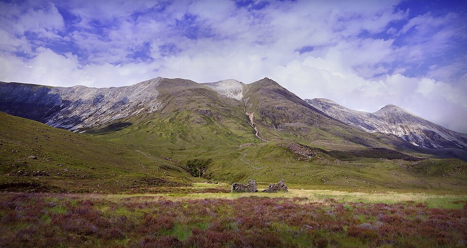
ViewFinderPanoramas's hard work collecting Digital Elevation Models of the entire world, with precise accuracy (less then 30 meters in Europe!) was critical for this project.
Data from the website was used to:
- Compile contour lines
- Elaborate hills shading
- Create a reliefs layer
Data MUST be used for research and private use only.
Since there is no logo on the website, I choosed a wikimedia photo picturing somewhere on the road to Gairloch taken by Charlie From Bristol
Natural Earth Data

Natural Earth Data datasets was used to compile the base layer of the map
Natural Earth is a public domain map dataset available at 1:10m, 1:50m, and 1:110 million scales. Featuring tightly integrated vector and raster data, with Natural Earth you can make a variety of visually pleasing, well-crafted maps with cartography or GIS software. Natural Earth was built through a collaboration of many volunteers and is supported by NACIS (North American Cartographic Information Society).
Natural Earth Data is free for use in any type of project: take a look at their Term of use
Open DEM
Open DEM was used as documentation to understand what DEM files are, and how they work.
Their incredible work was critical for me to understand how the whole process of mapping our earth goes on, from simple barometers to stellites.